The government has launched a national initiative to identify and document sites of geological and natural significance that could be nominated as UNESCO Global Geoparks, in a move aimed at promoting geo-tourism, education, scientific research, and environmental conservation.
According to Dominique Mvunabandi, the National Focal Person for the Geopark National Committee at UNESCO Rwanda, the exercise involves a comprehensive assessment of the country’s unique geological and natural heritage.
ALSO READ: UNESCO boss talks biodiversity
“These sites are being evaluated based on their scientific value, educational potential, and cultural importance,” he said.
Geological heritage refers to natural landforms and Earth processes with scientific, educational, cultural, aesthetic, or economic value—including rock formations, fossils, volcanoes, caves, and tectonic structures that tell the story of the planet’s evolution.
UNESCO Global Geoparks (UGGp) are defined as single, unified geographical areas where sites and landscapes of international geological significance are managed holistically—integrating protection, education, and sustainable development. There are currently 229 UNESCO Global Geoparks in 50 countries.
ALSO READ: Rwanda ranks 6th in wildlife conservation in Africa
Mvunabandi said that for Rwanda, the benefits include enhanced global recognition, increased opportunities for education and research, local economic growth through geo-tourism, and sustainable conservation of natural and cultural resources.
Rwanda’s list of candidate geopark sites is expected to be submitted to UNESCO by November 2025.
Bisoke’s crater lakes
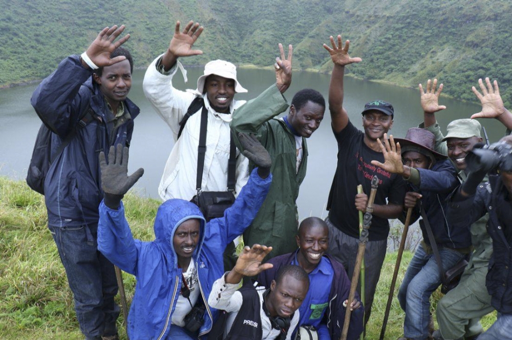
Among the top contenders is Mount Bisoke in Volcanoes National Park, whose summit lake—100 metres deep and 400 metres wide—is among the country’s most iconic volcanic features. A second lake, Ngezi, lies on the volcano’s slopes and offers sweeping views of Mount Sabyinyo.
ALSO READ: A journalist's gruelling hike to the summit of mighty Mount Bisoke
“These crater lakes and geothermal features make Volcanoes National Park a strong candidate for geopark status,” Mvunabandi noted, adding that a transboundary geopark linking Rwanda with Uganda and the DRC is also under consideration.
Nyungwe fault escarpments
In the southwest, Nyungwe Forest and its surrounding fault escarpments stand out for their geological and ecological significance. The region, underlain by ancient Precambrian rocks, lies within the Albertine Rift—one of Africa’s most active geological zones.
Nyungwe’s dramatic fault lines and rich biodiversity, coupled with its cultural heritage, make it a strong contender for UNESCO recognition.
ALSO READ: 'Unforgettable experience' in Musanze's underground caves
Tectonic lakes and geo-hazards
The western region, dominated by Lake Kivu and its surrounding volcanic cones and hot springs, illustrates Rwanda’s tectonic dynamism. Lake Kivu’s rare limnic eruption phenomenon—where gases trapped in deep waters can suddenly be released—makes it both a geological wonder and a geo-hazard study site.
Incorporating this area into a geopark would highlight the theme of tectonic activity, natural risks, and resilience.
Bugarama rift and travertine terraces
In Rusizi District, the Bugarama Rift features striking travertine terraces and geothermal springs, serving as a “natural laboratory” for studying tectonic and mineral deposition processes.
The formations, created by mineral-rich hot springs, hold strong potential for geoscience tourism and research.
Musanze basaltic caverns
Northern Rwanda’s basaltic caverns—lava tubes formed by ancient volcanic flows are another highlight. These underground caves, ideal for adventure tourism and education, showcase the country’s volcanic history.
Rugezi wetland and twin lakes
The Rugezi Wetland and the twin lakes of Burera and Ruhondo illustrate the connection between volcanic activity and wetland ecosystems. The area plays a key role in hydrological regulation and community-based conservation.
National coordination
To coordinate these efforts, the government established the Geopark National Committee, comprising representatives from the University of Rwanda’s School of Mining and Geology, the Rwanda Development Board (RDB), the Rwanda Mines, Petroleum and Gas Board (RMB), UNESCO Rwanda National Commission, and the Red Rock Initiative for Sustainable Development.
Joseph Mugabo, a seismologist at RMB, said robust scientific data including geological maps, stratigraphic profiles, and geosite inventories will be vital to the nomination process.
Cedrick Nsengiyumva, a lecturer at the University of Rwanda, highlighted Rwanda’s diverse geological record, spanning from ancient metamorphic rocks to recent volcanic formations.
Meanwhile, Professor Asfawossen Asrat Kassaye from the Botswana International University of Science and Technology, who is supporting the initiative, said:
“The Virunga volcanic chain and the Lake Kivu rift are of international scientific importance. A successful geopark requires globally significant geoheritage, community engagement, and a dedicated management body to ensure sustainable use and protection.”
He emphasised that systematic geoheritage inventories, local community involvement, and inclusive governance will be key to Rwanda’s success in securing UNESCO Global Geopark status.


